After a very productive year of research on an XSEDE Start Up Allocation on the Bridges supercomputer at Pittsburgh Supercomputing Center, the Urban Modeling Group has now been awarded a full Research Allocation (including 268,206.0 SUs on Bridges) as well as staffing support through the ECSS program. These valuable resources will be leveraged to continue work on indexing and data management systems for 3D spatio-temporal data.
Paper by Dr. Anh-Vu Vo one of ISPRS’s Most Cited Articles
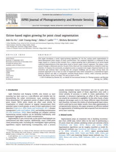
 Dr. Anh-Vu Vo’s 2015 paper “Octree-based region growing for point cloud segmentation” is one of ISPRS Journal of Photogrammetry and Remote Sensing’s most highly cited papers since 2015. The paper has been cited in 82 publications, according to Scopus.
Dr. Vo’s paper introduces a novel, region-growing algorithm for the fast surface patch segmentation of three-dimensional point clouds of urban environments, which proved to be at least an order of magnitude faster when compared to a conventional region growing method and able to incorporate semantic-based feature criteria, while achieving precision, recall, and fitness scores of at least 75% and as much as 95%.
ISPRS Journal of Photogrammetry and Remote Sensing is the #1 ranked journal in the field of remote sensing with an impact factor of 5.994. It covers work across photogrammetry, remote sensing, spatial information systems, computer vision, and related fields. The full list of highly cited papers can be found on the ISPRS Journal of Photogrammetry and Remote Sensing website.
Laefer Brings Subject Expertise to Multi-National Dense Urban Environment Projects
Through her work with military interests in the US, the UK, and Canada, Prof. Debra Laefer has provided critical subject expertise to stakeholders analyzing the increasingly crucial role of dense urban environments in military engagements. In addition to her continuing work with the US Army as a member of the Board of Advisors for the Dense Urban Terrain Detachment based at Fort Hamilton, she recently returned from a NATO sponsored trip to the Urbanisation Project Wargame at the Defence Academy, Shrivenham on September 2nd-6th, where she served as the Green Team co-leader. Laefer has also been invited to serve as the Green Team co-leader at the RDECOM Dense Urban Environment Wargame in Washington, DC later this fall.
As urban environments increase in complexity and density and more combat is conducted in these urban spaces, improved 3D intelligence and understanding of these environments will be vital to ensuring the efficacy of the US and their allies efforts in global combat zones. As this area of analysis has evolved, the Urban Modeling Group’s expertise in remote sensing, urban data collection, and 3D data management has been identified as a valuable contribution to efforts to improve approaches to urban engagement.
Urban Modeling Group Research Featured in GIM International and others
The Urban Modeling Group’s Prof. Debra Laefer and Dr. Zohreh Zahiri, in collaboration with University College Dublin’s Aoife Gowen, recently published two papers describing their groundbreaking research in hyperspectral imaging for building materials identification. The research demonstrated, for the first time, the ability to use hyperspectral imaging to characterize differing strengths within a single type of construction material (brick, concrete).
This technology will help civil engineers and developers rapidly analyze the integrity of construction materials and assist with the documentation, preservation, and restoration of historical structures, as well as the asset management of our infrastructure without requiring any destructive testing or even direct contact with the materials under investigation.
This work has since been featured by GIM International, Construction Dive, Hard Find Electronics, Pythom, and Phys.org.
The full press release is available from the Center for Urban Science and Progress.

